DEFENCE SYSTEMS PORTFOLIO

Six-Domain Capability Stack

An integrated portfolio combining underwater, aerial, land-based and electronic-security capabilities for defence, homeland security, border management, maritime agencies and critical-infrastructure protection.

SRD-01

UNDERWATER SURVEILLANCE DRONES

REQUEST BRIEFING
UNDERWATER SURVEILLANCE DRONES
SRD-01Autonomous subsea platforms for persistent maritime-domain awareness below the surface

Underwater Surveillance Drones are autonomous or remotely operated subsea platforms designed to extend maritime-domain awareness below the surface. They support persistent surveillance, hydrographic intelligence, seabed mapping, inspection and mine-countermeasure-related tasks while reducing the exposure of divers and crewed vessels. The system may be offered as an autonomous underwater vehicle (AUV), tethered remotely operated vehicle (ROV), or hybrid platform capable of autonomous and supervised operation. A low-drag, cylindrical body permits quiet underwater movement and accommodates deployment from shore, RHIBs, patrol vessels, naval ships or containerised launch-and-recovery systems.

Operational Use Cases

  • Harbour, port and naval-base surveillance
  • Coastal and offshore reconnaissance
  • Seabed mapping and hydrographic survey
  • Detection of underwater obstacles, wrecks and mine-like objects
  • Inspection of pipelines, subsea cables, jetties, vessel hulls and underwater infrastructure
  • Environmental-data collection including salinity, temperature, depth and turbidity
  • Maritime intelligence preparation and route surveillance

Technical Specifications

OPERATIONAL DEPTH300 M TO 3,000 M+
ENDURANCE20–72 HOURS (BATTERY)
TRANSIT SPEED3–6 KNOTS
NAVIGATIONINS / DVL / USBL / GNSS-ASSISTED
SENSOR PAYLOADSSONAR / EO-IR / CTD / MULTIBEAM
COMMUNICATIONSACOUSTIC MODEM / RF / SATELLITE
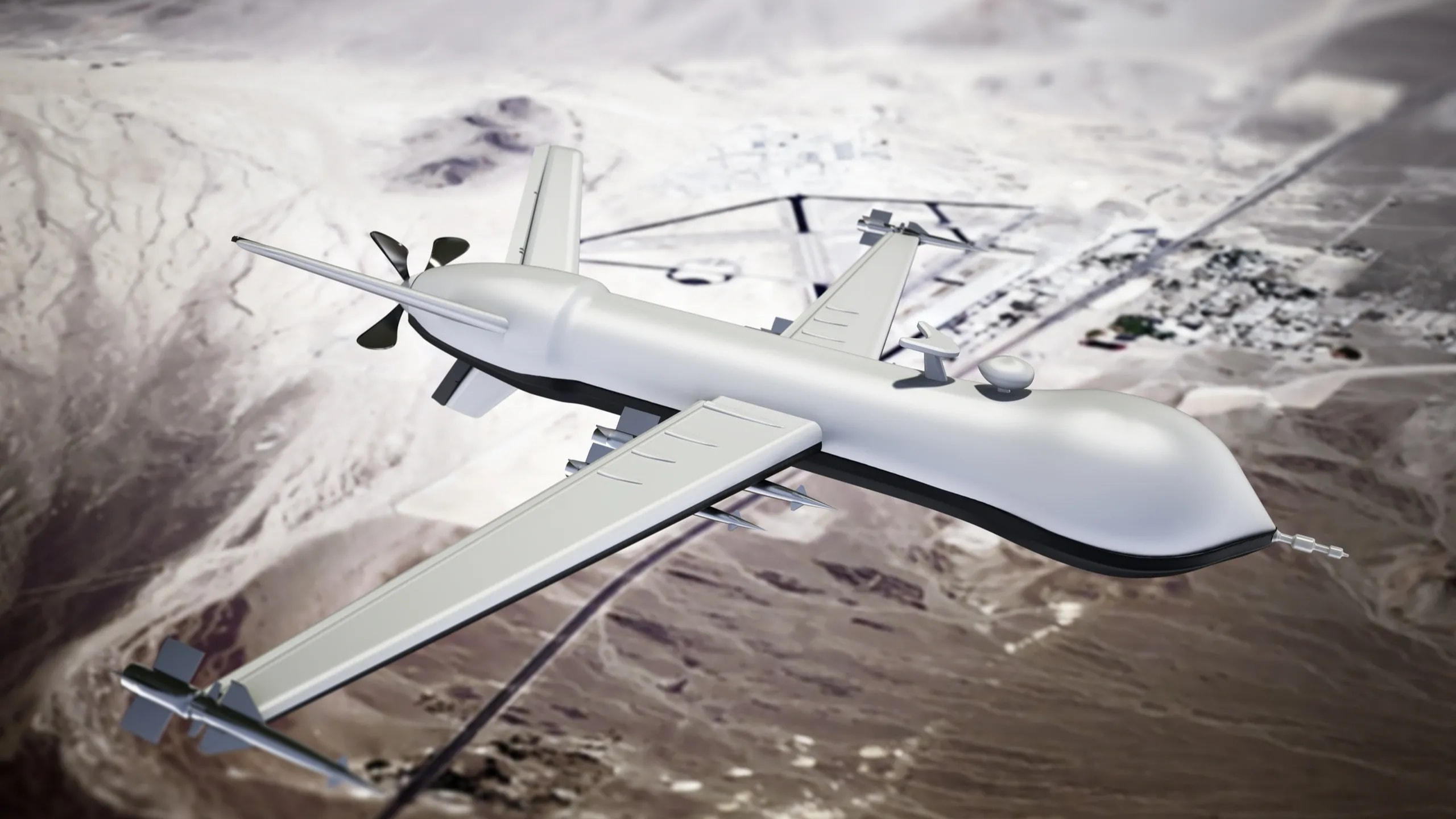
SRD-02

LONG-ENDURANCE MALE MILITARY UAV

REQUEST BRIEFING
LONG-ENDURANCE MALE MILITARY UAV
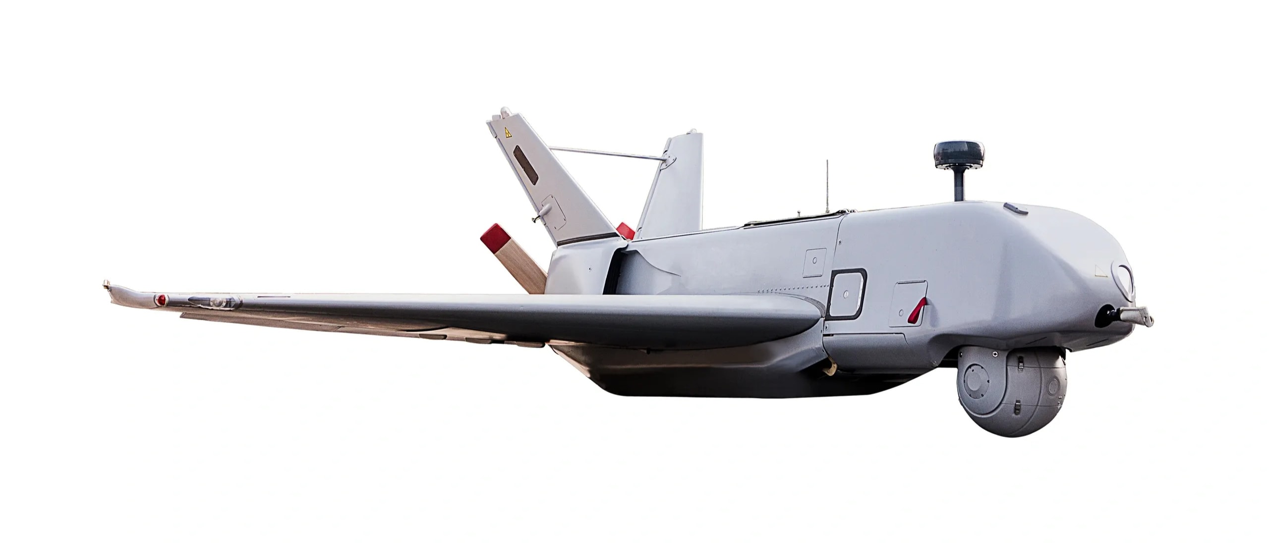
SRD-02Fixed-wing persistent ISR, target acquisition and communications-relay over large land or maritime areas

The Long-Endurance Medium-Altitude UAV is a fixed-wing, remotely piloted and optionally autonomous aircraft for persistent intelligence, surveillance, reconnaissance, target acquisition and communications-relay missions over large land or maritime areas. The system uses a high-wing, long-span airframe with pusher propulsion and modular mission bays. Its design objective is extended airborne endurance, enabling continuous coverage of borders, coastlines, remote infrastructure corridors and operational areas without frequent aircraft rotation. The platform provides persistence rather than short-duration observation — it can maintain coverage over a defined sector for extended periods, cue ground or naval forces with real-time intelligence and sustain a common operational picture.

Operational Use Cases

  • Long-range border and coastal surveillance
  • Maritime patrol and identification of suspicious vessels
  • Intelligence, surveillance, target acquisition and reconnaissance (ISTAR)
  • Persistent EO/IR observation and real-time video downlink
  • Synthetic-aperture radar and ground-moving-target indication missions
  • Communications relay for deployed forces
  • Signals-intelligence, electronic-support and electronic-warfare payload missions
  • Search-and-rescue coordination and disaster-response monitoring

Technical Specifications

WINGSPANAPPROX. 18–19 M
MAX TAKE-OFF WEIGHTUP TO 1,500 KG
MISSION PAYLOADUP TO 220 KG
ENDURANCEUP TO 30 HOURS
MAX RANGE4,000 KM+
SERVICE CEILINGUP TO 30,000 FT
OPERATIONAL SPEED110–150 KM/H
LOS CONTROL RADIUSUP TO 250 KM
SRD-03

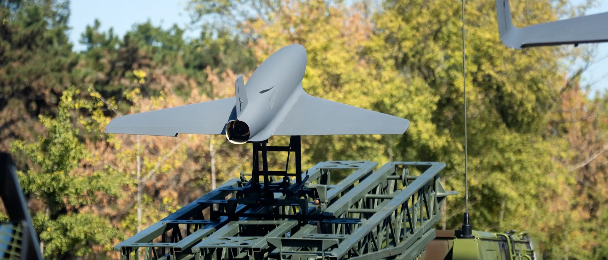
KALMAN-FILTER AUTONOMOUS UAV SYSTEM

REQUEST BRIEFING
KALMAN-FILTER AUTONOMOUS UAV SYSTEM
SRD-03Mission-configurable fixed-wing platform for GNSS-degraded, denied and electronically contested environments

This autonomous UAV system is a mission-configurable fixed-wing platform built around Kalman-filter-based sensor fusion, onboard navigation, secure communications and autonomous mission execution. The flight-control architecture combines inertial measurement data, barometric altitude, airspeed, visual-navigation inputs and available satellite-navigation data through a Kalman-filter estimation engine. It continuously estimates aircraft position, velocity, attitude and sensor confidence even where individual navigation sources become unavailable or unreliable — reducing dependence on any single positioning source and maintaining a reliable flight-state estimate during GNSS interference, signal loss, poor visibility or changing mission conditions.

Operational Use Cases

  • Autonomous reconnaissance in GNSS-degraded and denied environments
  • Border, coastal and remote-area observation
  • Forward-area intelligence collection
  • Infrastructure and corridor monitoring
  • Battle-damage assessment and post-event imagery
  • Communications relay and situational-awareness extension
  • Rapid launch from dispersed or temporary operating locations

Technical Specifications

MAX TAKE-OFF WEIGHTUP TO 40 KG
PAYLOAD CAPACITYUP TO 12 KG
MAXIMUM SPEEDUP TO 230 KM/H
OPERATIONAL CEILINGUP TO 6,000 M
MISSION RANGEUP TO 650 KM
MAX ENDURANCEUP TO 9 HOURS
LAUNCH METHODMOBILE CATAPULT / RAIL-LAUNCH
COMMUNICATIONSFREQ-HOPPING / MULTI-BAND / JAM-RESISTANT
SRD-04

FIXED-WING VTOL SYSTEMS

REQUEST BRIEFING
FIXED-WING VTOL SYSTEMS
SRD-04Runway-independent fixed-wing performance with vertical take-off and landing flexibility

Fixed-Wing VTOL systems combine the runway independence of a multirotor aircraft with the range, speed and aerodynamic efficiency of fixed-wing flight. The aircraft takes off and lands vertically using dedicated lift rotors before transitioning into efficient forward flight using a fixed wing and cruise propeller. It can be deployed from small clearings, rooftops, ships, forward posts, disaster locations and confined infrastructure sites — bridging the capability gap between multirotors and conventional fixed-wing drones while retaining the field-deployment flexibility of vertical lift.

Operational Use Cases

  • Border and perimeter surveillance
  • Long-range reconnaissance and mapping
  • Coastal, riverine and maritime observation
  • Powerline, pipeline, railway and road-corridor inspection
  • Emergency response and disaster assessment
  • Agricultural, forestry and environmental monitoring
  • Lightweight time-critical payload delivery in difficult terrain
  • Tactical surveillance for law-enforcement and security users

Technical Specifications

CONFIGURATIONFIXED-WING VTOL HYBRID
TAKE-OFF MODEVERTICAL — NO RUNWAY REQUIRED
LIFT SYSTEM4+ INDEPENDENT LIFT ROTORS
CRUISE PROPULSIONREAR PUSHER / TRACTOR
PAYLOAD OPTIONSEO / THERMAL / MAPPING / LRF
RECOVERYAUTO PRECISION LANDING / PARACHUTE
DEPLOYMENTSHIP / ROOFTOP / CLEARING / FORWARD POST
NAVIGATIONGNSS/INS / TERRAIN GEOFENCING / RTH
SRD-05

MODULAR SHORAD/VSHORAD & INTERCEPTOR-DRONE DEFENCE SYSTEM

REQUEST BRIEFING
MODULAR SHORAD/VSHORAD & INTERCEPTOR-DRONE DEFENCE SYSTEM
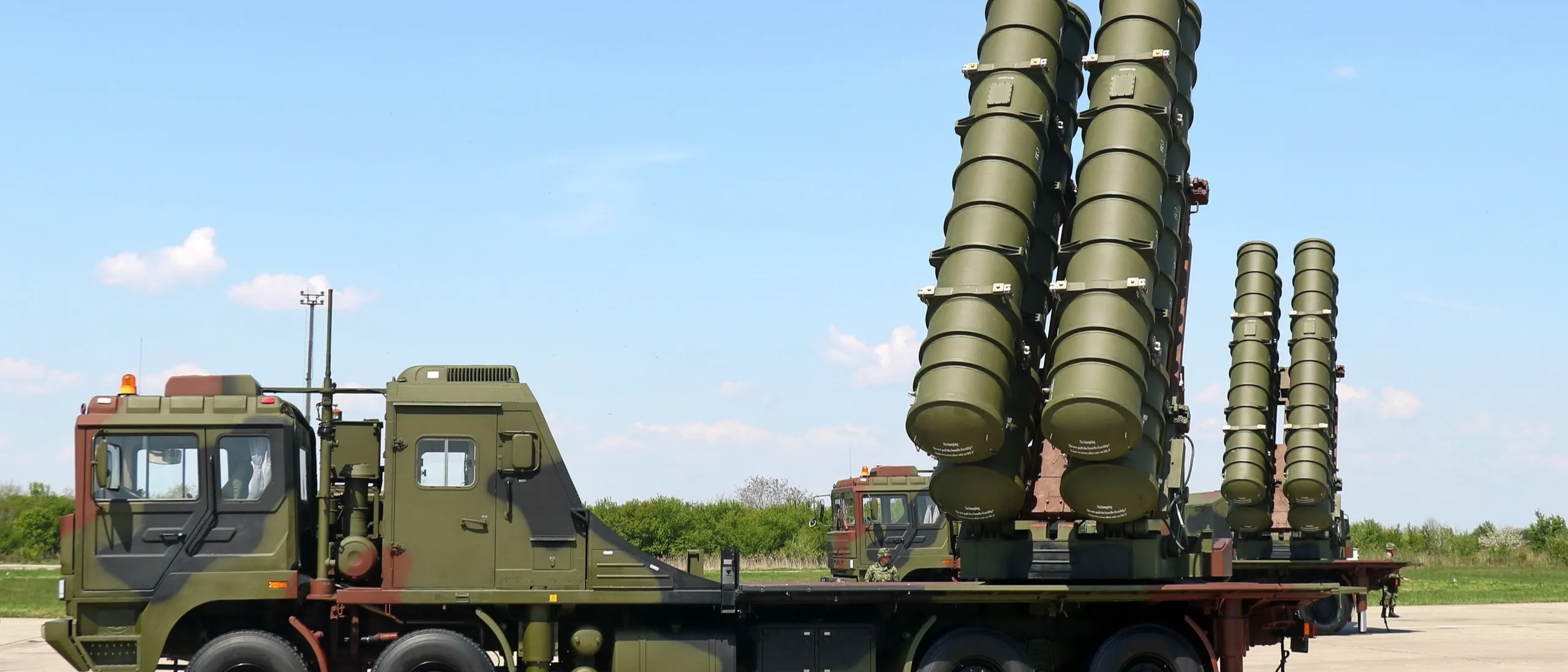
SRD-05Layered vehicle-mounted air defence protecting formations, strategic assets and critical infrastructure from low-altitude threats

The Modular Short-Range and Very-Short-Range Air Defence System is a layered, vehicle-mounted and network-enabled architecture intended to protect military formations, strategic assets and critical infrastructure from low-altitude aerial threats. The architecture integrates sensors, command-and-control software, weapon modules and interceptor drones in a common air-defence network: Sensors → C2 and Threat Evaluation → Fire-Control Unit → Kinetic and Non-Kinetic Effectors. It can function under centralised command or in decentralised mode if communications are degraded. The open architecture enables integration with customer-selected surveillance sensors, weapon systems and command networks.

Operational Use Cases

  • Protection against small multirotor drones, fixed-wing UAVs and coordinated swarms
  • Defence against loitering aerial threats and low-flying aircraft
  • Rotary-wing and hovering helicopter engagement
  • Short-range cruise-missile threat defeat
  • Forward operating base and critical asset protection
  • Convoy and mobile force air defence
  • Naval vessel close-in air defence
  • VIP and high-value asset protection

Technical Specifications

SURVEILLANCE3D RADAR — 360° WIDE-AREA DETECTION
IDENTIFICATIONEO/IR TRACKING — DAY/NIGHT
PASSIVE DETECTIONRF SIGNATURE — DRONE CONTROL/VIDEO LINK
KINETIC EFFECTORSGUN MODULE / MISSILE / VSHORAD
INTERCEPTOR DRONENET CAPTURE / CONTROLLED INTERCEPTION
ECM MODULERF / NAVIGATION-LINK DISRUPTION
MOBILITYVEHICLE-MOUNTED / SHOOT-AND-SCOOT
C2SENSOR FUSION / THREAT PRIORITISATION
SRD-06

COUNTER-DRONE COMMUNICATIONS NEUTRALISATION SYSTEM

REQUEST BRIEFING
COUNTER-DRONE COMMUNICATIONS NEUTRALISATION SYSTEM
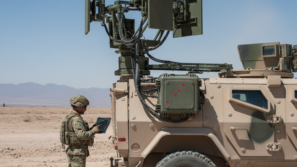
SRD-06Fixed-site or vehicle-deployable electronic-security system preventing unauthorised drone access to protected perimeters

This is a fixed-site or vehicle-deployable electronic-security system designed to prevent unauthorised civilian drones, quadcopters and small UAVs from entering, overflying, landing within or collecting information from a protected perimeter. The system detects relevant drone-control, telemetry and video-link activity and applies controlled RF countermeasures in authorised bands. It creates a protected zone that disrupts the communications pathways used by common civilian drone systems, causing a target to lose effective command-link continuity or trigger its programmed fail-safe behaviour. Electronic countermeasures must be deployed only by appropriately authorised users and in accordance with spectrum-management rules, aviation-safety requirements and local law.

Operational Use Cases

  • Protection of military bases, ammunition depots and airfields
  • Security for government buildings and strategic facilities
  • Protection of ports, refineries, power plants and telecommunications sites
  • Stadium, event, VIP and public-gathering security
  • Prison-perimeter security
  • Convoy, checkpoint and temporary-forward-base protection
  • Counter-surveillance against commercially available quadcopters

Technical Specifications

COVERAGE360° OMNIDIRECTIONAL / SECTOR-BASED
EFFECTIVE RADIUSUP TO ~500 M OMNI / LONGER DIRECTIONAL
TARGET TYPECIVILIAN / COMMERCIAL UAV — RF/WI-FI LINKED
OPERATING BANDSCONFIGURABLE — AUTHORISED FREQUENCIES
DEFEAT METHODNON-KINETIC RF DISRUPTION
DEPLOYMENTFIXED / MAST / ROOFTOP / VEHICLE / PORTABLE
ALERTSAUTO SMS / CELLULAR / IP ALARM
PROTECTIONWEATHER-RESISTANT / FAULT / OVER-TEMP

INITIATE PROCUREMENT DIALOGUE

Classified system briefings available for authorised defence procurement officials and armed forces representatives.

SUBMIT DEFENCE INQUIRY